With it being a holiday weekend, beautiful weather, and my brother in law visiting from out of town, it was determined that today would be a hiking day!
So after discussing with my hubby, we decided that several short hikes and a longer hike in the Pisgah National Forest was a great idea for the best views for the drive.
Time wise, we left Black Mountain at 1:15pm and got back home at 7:15pm.
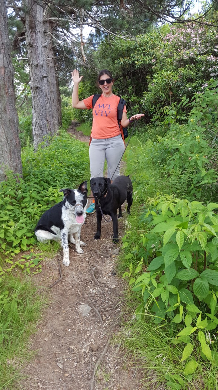
We set out after lunch down the parkway (approximately 1 hour 15 minute drive to our location). Packed snacks, water, 2 dogs, 2 kids, my brother in law and I on the road. He hasn’t been on the parkway in close to 20 years so this was a treat for him!
I decided we should start furthest out and hit each spot coming towards Asheville.
Devil’s Courthouse.
This wasn’t my first trip there (so some of the photos will be from a cold wintery day, and some from a nice sunny day
Start on the Blue Ridge Parkway, South. From Black Mountain it took amhjvbjround 1 hour 15 minutes.
Mile Marker 422.4
Elevation Peak: 5720feet
Hike Elevation Change: Approximately 240ft
Distance: Round Trip 0.95mile from parking lot
Hiking Time: 15 minutes time to hike roundtrip
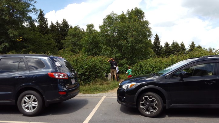
If you are driving from Asheville, you will pass under the Devil’s Courthouse Tunnel immediately before the entrance on the left. The parking area is .2m down from the actual entrance off the parkway.
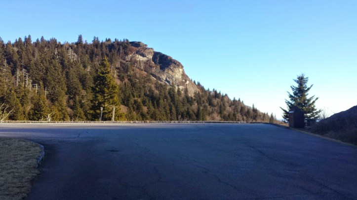
There is a short walk along a sidewalk to the entrance in the woods, then the steep ascent begins. Its not long (the incline only lasts .25-.3m), but the 240ft incline starts on pavement with warning signs to not touch the plants, etc. Theres a little poison ivy noted along the grass off the pavement. Towards the top of the trail it becomes gravely/rocky and a there are a few stairs immediately before you reach the rock.


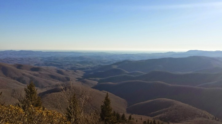
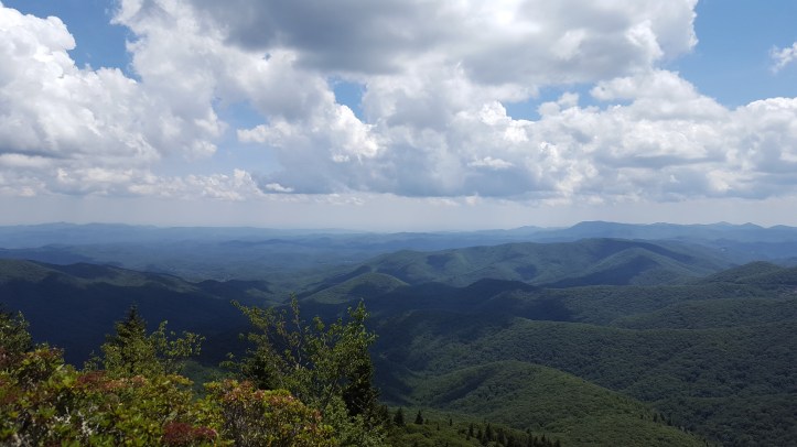
The top does have a wall around the viewing area so kids aren’t dropping off the side of the mountain. There are warnings about staying on the viewing area as well. The view from the top is beautiful and goes on for a long distance. I can now see I’ve seen this in the winter and summer and both are beautiful.
A note to add, in the winter the parkway is closed, so the entrance we took was off of 216 through Waynesville and Canton. We had to park at the blocked gates and walk 1 mile to Devil’s courthouse down the parkway.
After we returned to our car, we rode North on the Parkway to mile marker 420.2, took a left onto FR 816 that goes up to Black Balsam and Sam’s Knob parking areas.
Black Balsam Knob
I’ve included a map below. I walked into this hike with a few other blogs to follow off of, but no distinct map. I have a Pisgah National Forest hiking book, but still, the Black Balsam Loops described are not close to what we did. However we did cross Black Balsam knob and this was a gorgeous hike. The information I’ll be giving you is my experience and I hope it helps you!
Hiking Time: 1hr 45 minutes
Hiking Distance: 3.26miles
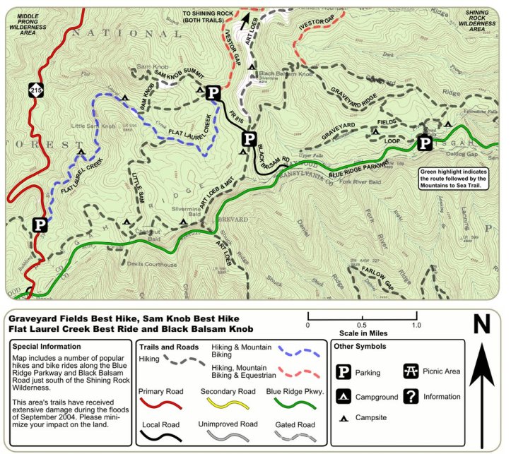
We pulled up to the first parking area as we intended to enter at the Art Loeb Trail entrance. This is a parking area along the side of the road on the right.
As you walk in, you’ll see the entrance to the Mountains to Sea trail that will go off to the right, but the Art Loeb Trail goes straight forward.


You’ll start into the woods at first with stairs and inclines before you start into the open meadow.


The views are beautiful. Crawling hills in the open air. Beautiful views! Like walking through a hilly meadow.
We make it to the top of Black Balsam Knob where I have a panoramic view. There is also the rock labeled for Art Loeb.


After cresting the knob, we continued on the trail cresting the knob and over the hill. We stayed straight and to the right as if we were continuing to Shining Rock. The trail deepens into the ground and the surrounding rhododendron get taller. We continue down the hill until we get to a orange rock and a clearing (this is just before you go back up the next hill.


At around the 1.25 mile mark, we turned left at the orange rock and headed down the trail for perhaps 1/4 mile(?) until we reach the old logging road. The trail and the logging road are relatively flat and much easier to walk along.
We took a left onto the logging road. Crossed a few small (tiny) creeks.


Towards the end of the road, before the parking lot, we see a natural spring on the left. We filled our water bottles at this! It was very good fresh water!
This puts you out at the Sams knob parking lot, so once you get to the road, take a left and head back to the Black Balsam parking lot.
Our total loop was approximately 3.26 miles and took 1 hour 45 minutes. However, you could have gone further down the Art Loeb trail and found another shoot off to the left to the Logging trail further down as well to make the loop longer. We just were unsure of how far to go.
Graveyard Fields Lower Falls
Our final stop was Graveyard fields. Mile post 418. It was after 5pm, so the crowds had died down. But it was still pretty warm. We took the stairs by the bathrooms down and followed the path, trails, fiver crossings until you could not go down any further. This put you at the base of the lower falls.
Hike length .6 miles round trip
Hike Time: 20 minutes round trip.
There are a lot of stairs going down, so you have to climb them to go back up. I recommend you take flip flops and clothes you can get wet in, because at the base of the falls, there is a great swimming hole!


