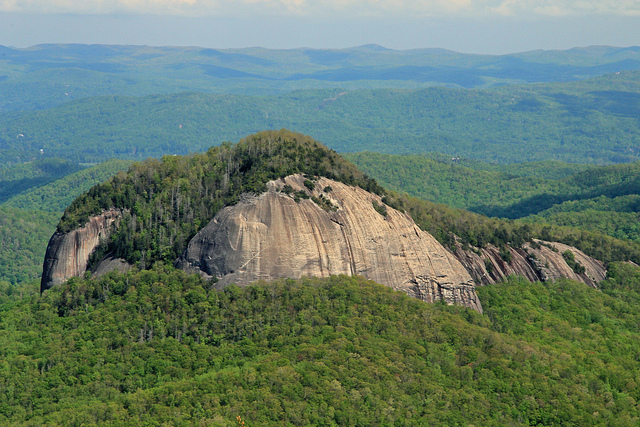
Ever drive down the Blue Ridge Parkway and as you’re nearing Graveyard Fields in the Pisgah National Forest, notice the huge mountain that sticks out with the open rockface? At approximately mile marker 417 is the overlook for this rock (BTW this is also the same mile marker you park at to reach Skinny Dip Falls, as you may recall from my previous blog). I’ve been wanting to climb this trail for at least a year now, as I started hearing more people take it.
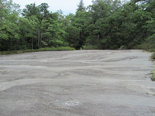
Not to be confused with Looking Glass Falls, as I always do, however the start of this hike is close to the falls. The easiest way from Asheville is to drive to the Asheville Airport Road Exit off I-26, take a right and drive approximately 16 miles towards Brevard. At the junction at the grocery store were 64 goes East and West and 276 goes straight or Right (West), take a right. You’ll immediately see the signs for Pisgah National Forest. Go approximately 5.2 miles and you’ll see an unlabeled road off to the left (it does have a sign for the Pisgah National Forest Educational building), this is Forest Road 475. If you actually reach the falls (they are only a .1-.2 mile up on the right, you’ve gone too far). Take this left and go approximately .4 miles and you can’t miss the pulloff on the right.
From Fairview, this took our crew approximately 50 minutes to reach our parking spot. Assume an extra 20 from Black Mountain.
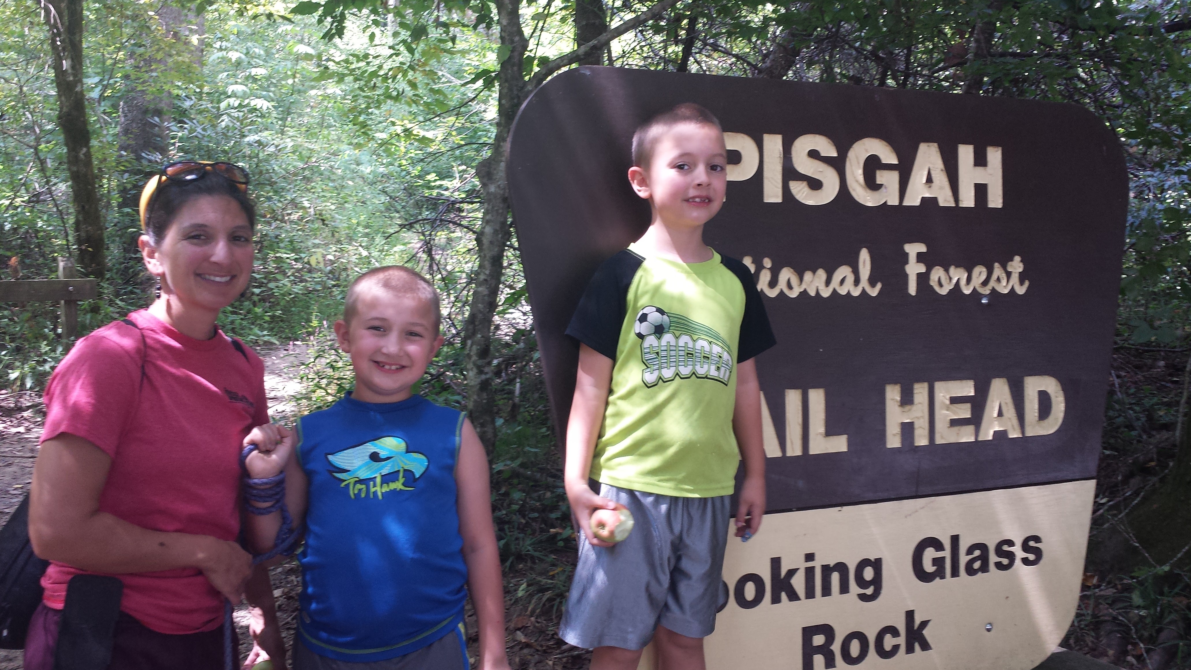
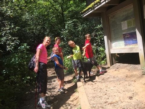
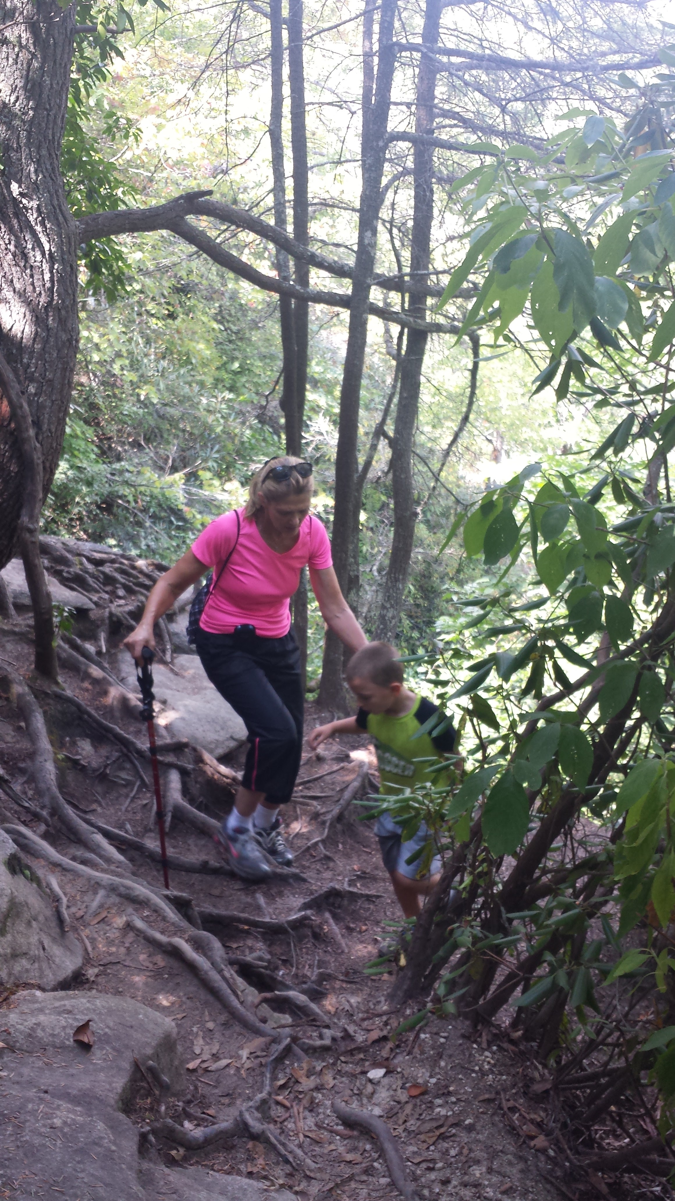
On this hike it was me and my boys (7 and 9yrs old), my mom, my sister, and her boy (10yrs old), and of course Lizzy.
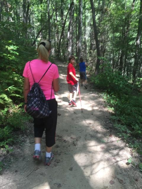
This trail is well marked at the start and the trail is well worn. There are yellow blaze marks on the trees, and there is a mark that tells you when you hit the 1 mile mark (mapmyrun was actually very close to accurate at that mark), however I never saw anymore mile markers (I may have just overlooked them).
Also note, there is no water on this trail to stop and let your dogs drink from, etc… so plan ahead with snacks and water.
Don’t let anyone fool you. This hike is moderately difficult and feels much longer than it is. But its an amazing workout, a very popular hike, and worth doing at least once.
The 1-way mileage according to my mapmyrun told me we hiked 2.87miles from start to the rockface. Other posts say its more like 6.5m roundtrip, though… I read a posting that stated it should take a strong hiker approximately 1.5 hours to reach the top. I felt we are decent hikers, but it took us 2 to get up, probably 1.25 to get back down. So plan ahead on time.
The trail starts out relatively easy going for the first mile. A slow incline on a decently wide and well traveled trail. Just before reaching the Mile 1 marker, we slowly increase the climb and slowly start the switchbacks.
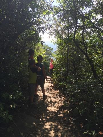
You’ll notice that at first you’ll walk about .1 of a mile before a switchback, but over the distance and as you go higher, the come at a much quicker pace. Towards the top of the switchbacks, one corner has an outlook, I didn’t get a great picture, but it was a tiny example of what the rock above will feel like… just opens into space.
There are shortcuts that were created along each of the switchbacks. However after my kids were determined to take a few, we raced them to see if it truly was a shortcut, and it wasn’t. Therefore, it is recommended that hikers don’t add to the destruction of the trails by continuing up these shortcuts.
Leading into mile 2, the trail does flatten out some for a very short time. Some interesting things around that area, you’ll pass a large rockface on the right leading up. I’m not sure where it led to, however with the kids we were not willing to explore, not to mention there was only rock so slipping would be easy to do there and not have a safe place to land. There is also an open flat granite rock off to the left surrounded by trees. Apparently there is no trail offshoot from it, but it sits as a heli-pad. Due to search and rescues in this area, this is something it is used for.
Slowly the trail increases in steepness and it becomes more stair-like as you are climbing higher and higher to reach the elevation that is needed.
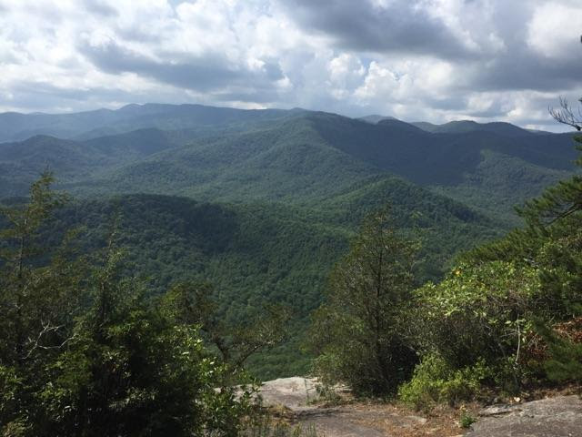
 This will continue until again closer to the top (about 10 minutes from the top) it actually will flatten out as you pass the summit of the mountain and go downhill. That was such a nice break on our legs! You will then reach the opening onto the rock (Upper Looking Glass Cliffs) as a bright light of the sun highlights the exit of the trail!
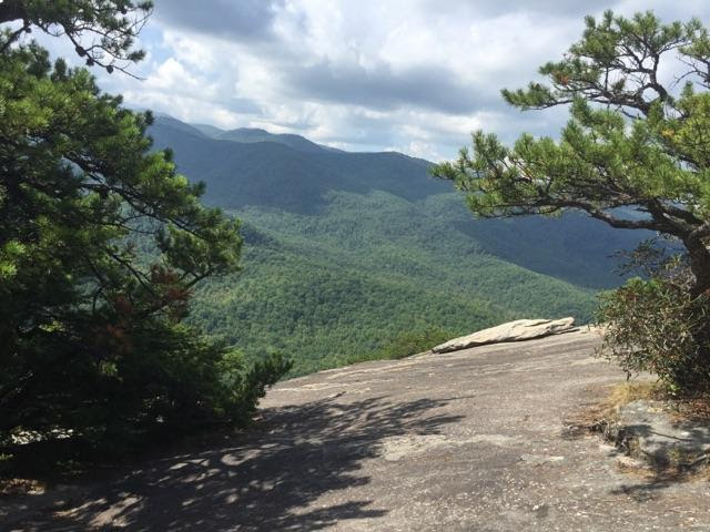
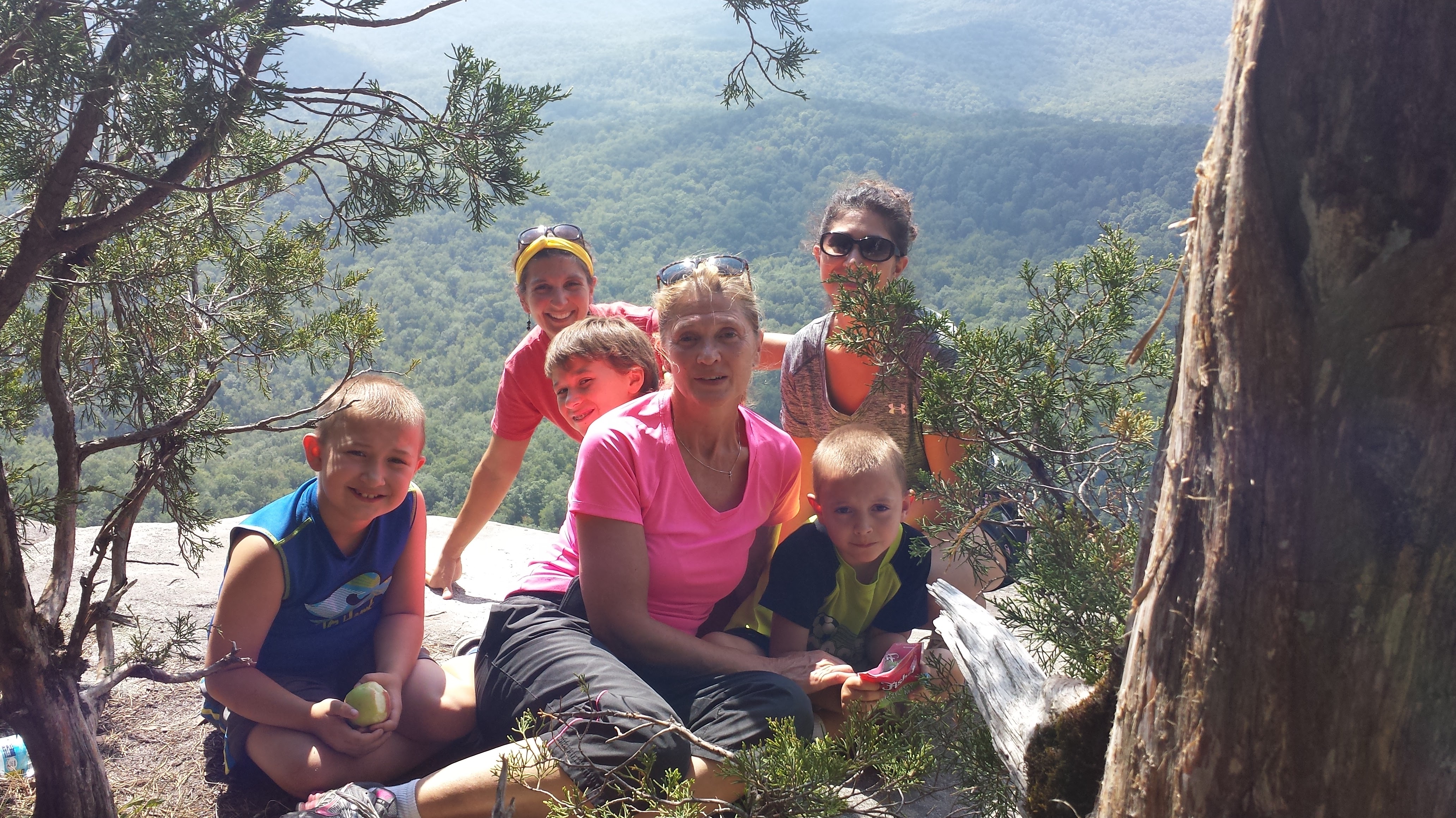 It’s actually a little scary at the top, mostly due to having the kids and the dog with us made us very nervous. I set my water bottle down beside my bag at one point to give my mom my phone to take a picture and my bottle rolled right off the mountain/rock…
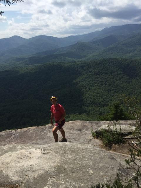
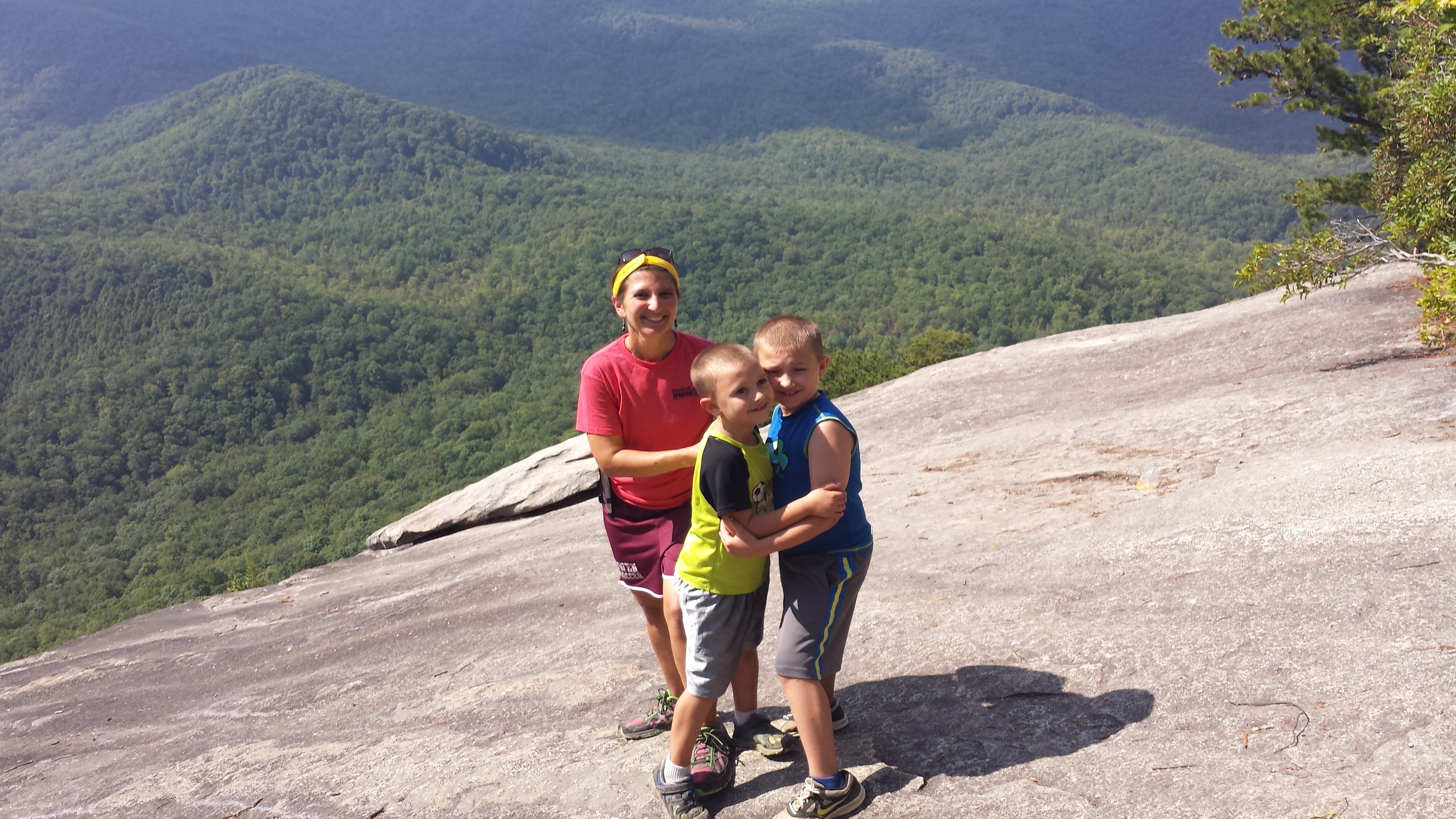
There are no barriers and the entire rockface is on a slight slant and drops right off the side. So proceed with extreme caution. We stayed more to the top with the trees while we ate snacks and scooted forward to take a few pictures, then scoot back. Kids were forced to hold hands before they moved anywhere.
 Apparently there was a death 2 weeks ago up off this mountain as a 68 year old man literally disappeared from his family up there (they turned around and he was gone) and he was found at the base by a hiker, so again, keep cautious. Although all the reports I read stated that there are only 2-3 rescues per year and usually its for the rock climbers, not people falling off the top. There was a rock climbing rescue in June 2015 as well, looking at recent events.
So now that I have scared the fear into you, this is a very good hike for a workout, and there are places to relax at the top and just enjoy the view, just be careful. Be more careful if you bring kids.
Round trip it took us approximately 3:45 hours to climb this round trip, and was approximately 5.76 miles roundtrip.
3969FT Elevation
Hike gains 1649ft, which mapmyrun was off by just a little on.
 I would love to hear other experiences! But that is mine!
