3 years ago we discovered the Falls at DuPont State Forest. Since then it has become our favorite hiking area for new people to the area! I recommend taking a small bag on your back with water friendly shoes (switch out your tennis shoes or hiking shoes when time to play in the water friendly areas), a small hand towel, snacks, and water. Consider packing a lunch! There are picnic areas by Triple and High Falls. There are no trash cans as it is not promoted to have trash out to attract the bears. So plan to carry any trash you have back out with you.
To find more information on this go to http://www.dupontforest.com
There are a good number of hikes you can try here, and at least 5 waterfalls, but perhaps not all in 1 day! I’ll start with what I believe to be the best hike to start with to see multiple falls on a 4.5m hike.
To Reach this location: Starting at the Asheville Airport follow NC-280W Until reaching 64W intersection. At this point you will see signs for DuPont State Forest. Take a left at the light onto 64W until reaching Crab Creek Road. Take a left onto Crab Creek and go 4.3 miles. Take a right onto DuPont Road/Staton Rd going 2.7 miles. The visitor’s Center will be on the left.
What to pack in your bag? Sandals or flip flops that can get wet, small towel (to dry your feet before putting your shoes back on), snacks, water, or anything else you may need if you were in the woods for 2 hours. There are no trash cans, vending machines, and nor water fountains on these hikes.
Also, a cell phone charger. In many parts of this hike, your cell battery will be drained due to trying to find signal while you are there. You may lose signal entirely, so if your group separates, make sure you know the plan because you may not be able to reach each other again (yes- this has happened to us on multiple occasions leading to either sitting and waiting for group members that you have no idea if they are coming… or walking aimlessly looking for each other)
Starting at the Visitor’s Center a perfect 1st hike would include a 4.5mile hike going to High Falls, to Triple Falls, and then Hooker Falls and then back to the Visitor’s Center. I recommend grabbing a map from the Visitor’s Center before you go. Here is a link to grab one…


Starting at the Visitor’s Center, start on the gravel trail, following signs to High Falls. After the first .25 miles the trail gets a little more rough and there are some uneven hills going up and down and a few turns until you reach the High Falls View.
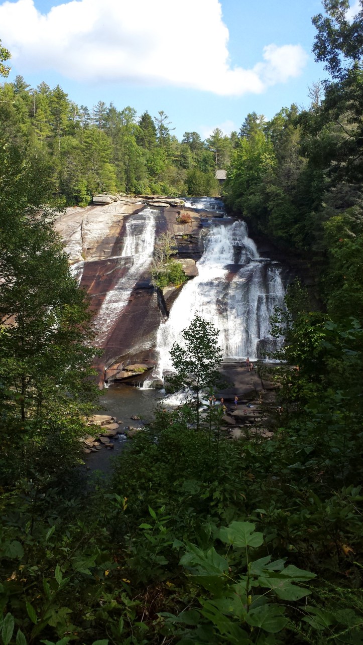
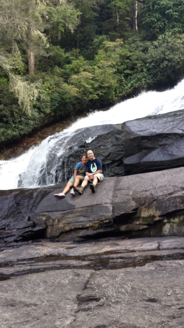
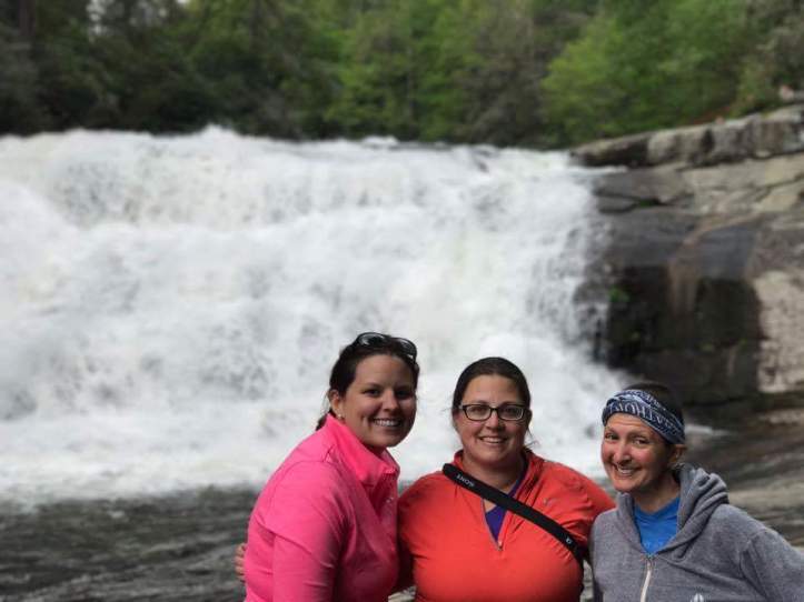
After getting the full photo, continue down the hill until you reach the river road off to the right. It leads to the bottom of High Falls and gives you the chance to get up close and personal with the bottom of the falls. Be Careful, there are signs everywhere regarding your safety. Wet rocks are very slick. However as long as the water is normal, there are waterholes to swim in and around.


After seeing the views, head back out river road til you reach the main trail again and continue following the river. It widens and leads to the middle of Triple Falls. A set of stairs to the right will take you down to the rocky base of the top 2 falls of Triple Falls.
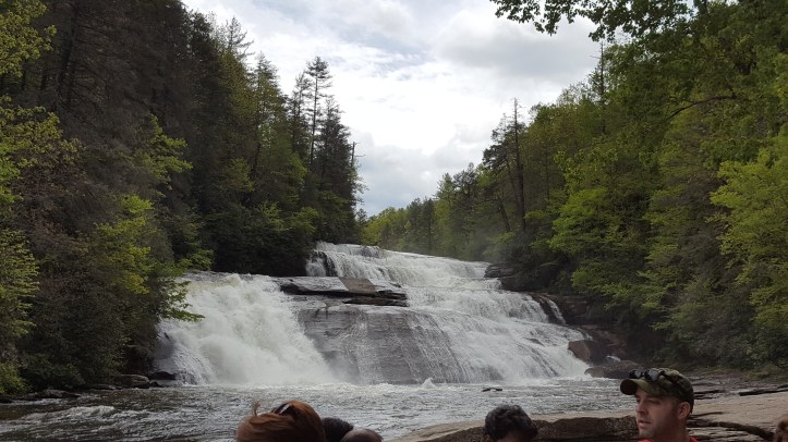
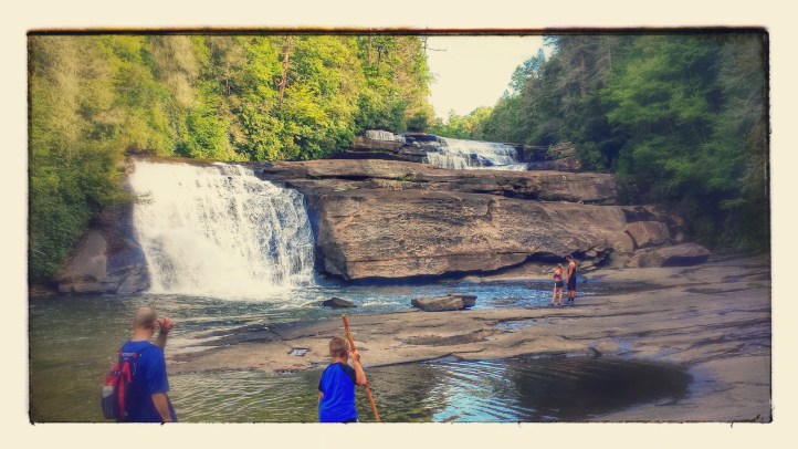
After heading back up the stairs, continue down the hill to the view of all 3 falls of Triple Falls. (The pictures below are indicative of a normal view on the left, and a view after lots of rain on the right)


A little further down are trail entrances that lead to the bottom of the 3rd part of the falls. Recent rains have destroyed trails that are closer to the bottom of the falls, but if you take the trail that opens first to the right, follow the edge of the river to the right on the rocks/shore until you reach the bottom of the falls. Another great picture spot.
Once you return to the trail, you’ll continue down the steep hill until it flattens out, you walk under the road, and cross the bridge. The Hooker’s Falls parking access is right here, however there is a short trail to the left that leads to Hooker falls. Walk over until you pass the falls and down the hill is a place you can stop to play in the water or just sit and rest while dangling your feet in.


You can return back to the Visitor’s Center by the same trail, or by a more direct trail that heads back to the visitor’s center while skipping High Falls. You’ll be going back uphill most of the trip back to the car.
If you want to add on more to your day, see the link to Bridal Veil here for an additional 4 mile hike to a gorgeous fall!
Have Fun!