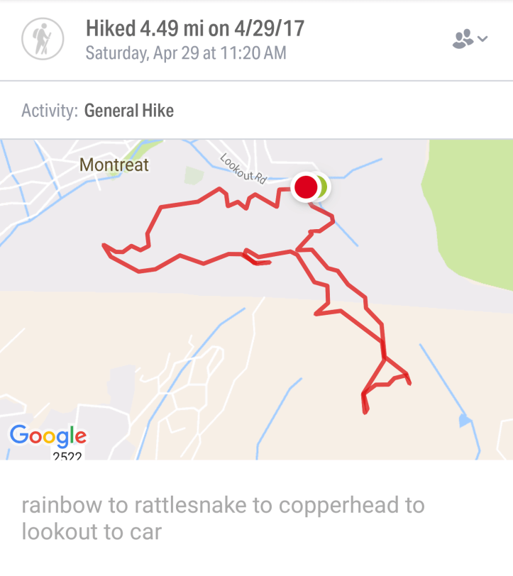
Making a huge 4.5 mile loop, our family set out to hike to Rattlesnake Summit in Ridgecrest. However we chose the route starting in Montreat. This big loop gave us the ability to hit 3 summits (Rattlesnake, Copperhead, and Lookout Trace) and see 3 gorgeous views.
The hike starts at the base of Lookout Trace Mountain.
This starts relatively flat with some slight inclines/declines, however towards Rattlesnake summit the climbs are much steeper and as you are approaching Lookout Summit, it again is a steep incline. The Trip from Lookout back to the car is mostly all downhill.
A Map of Montreat can also be found here. Click Here
Looking at the bottom of the map you will see trails 3 and 4. You will be starting at the point between those numbers, but following 3 (Rainbow) initially.
To reach this, Drive into Montreat until you pass the Parks and go over the bridge. Immediately take a right onto Lookout Road. Follow up the mountain until you reach the 2 parking areas on your right. This will be immediately before the road turns gravel. There is a big rock at the upper parking lot indicating the trailhead.
You can park in either lot however the trail you’ll start on is in the back of the lower lot. Rainbow Road trail.

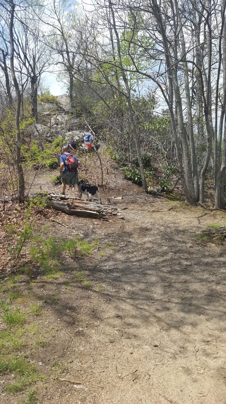
There is a gate that makes it appear closed, however it is not closed to foot traffic. Walk on past and enjoy the nice flat wide trail with a mountain wall on your left, and a drop off on your right.
You’ll follow until you reach a paved road. Cross the road to continue on the trail, which walks right by homes.
You’ll come to what appears to be a Y in the road. Turn to the left and go up the hill. Again as you reach an open space in the forest, you’ll see a trail off to the left and right- take the trail to the left, which keeps you on Rainbow Road. This will take you to the toll road.
The trail straightens out and you’ll come to another trail split. There is a big sign that says ‘This trail is not on the Montreat Trail system/Map’ on the trail to the right. Choose the trail to the left. (I make this mistake everytime… we get a little bit down the trail and realize we shouldn’t have taken the right yet)
Note to self: Stay on left sided trails until you see the sign for Rainbow Gap!

Around a quarter mile later you hit yet another split. This time you will take the trail to the right. This is the Mitchell Toll Road. If you take the left, it will take you to Lookout Trace. We are not ready for this yet. At this time you will be walking with the mountain wall on your left and the drop off on your right.
You will slowly be walking an incline at this point on the toll road around the mountain until you finally reach the sign that indicates you are on Ridgecrest Trails and a sign for Rattlesnake summit. Take the right at this point towards Rattlesnake Summit. (You will see this area again as you are coming back from Rattlesnake and Copperhead). The trail stays wide but starts to have more significant inclines and declines.


Although you will see a sign for Copperhead off to your left,

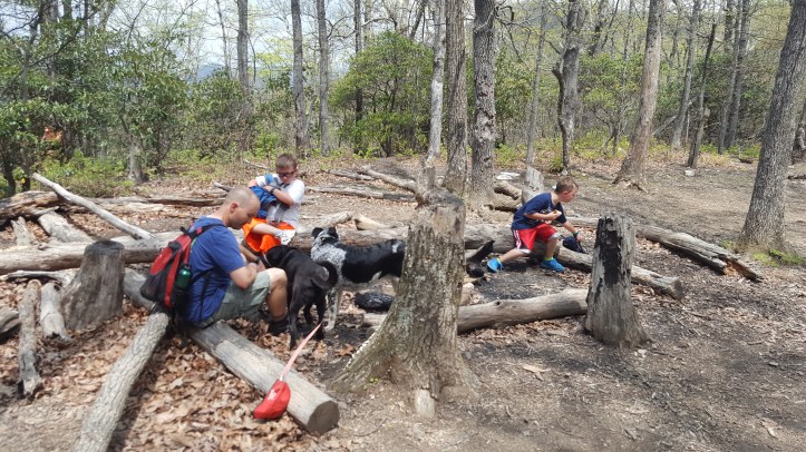
continue straight until you see the firepit/camping spot at the bottom of the hill. You are just a climb away from Rattlesnake summit. It is a nice climb up the mountain to the summit. Gorgeous 360 panoramic view.


We started to eat lunch on the summit, but decided it was too hot, so we packed our lunches up and headed back down to the firepit/camping area to eat in the shade.
From here you can continue on to Copperhead. You’ll see a trail off to your right that you will take as if you are heading back to Ridgecrest. Not long after you start the trail you will see a sign to your left to head to Copperhead Summit. Follow this trail up until you reach the summit.


You can return the way you came or follow the trail loop around and come out where you saw the sign earlier on your way to Rattlesnake. Take a right on the trail.


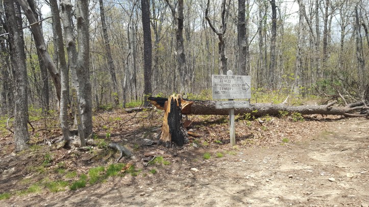
At the top of the trail where you entered Ridgecrest Trails on Old Mitchell Toll Road, you’ll see that you could return the way you came by taking a left, or take a right to Lookout Trace. There was a huge tree down over the trail to the right, but we hopped over it and continued that way.
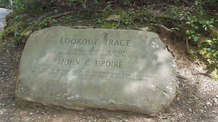
You’ll see a sign to your left for Hickory Ridge Trail to Lookout trace and it is a nice uphill climb approximately .25 miles to the summit.


The Summit for Lookout does not have gorgeous views.


You have to continue on the trail for that big rock. Once you leave Lookout Summit, its all downhill. Except one hill right before the big rock…
Continue on the trail down the hill until you reach the big overlook Rock.


Then continue down the rock, wooden stairs, steep grade mountain. (the view below is looking from below-up)


Its only .5 miles to your car from the lookout rock. If you are a good hiker, this won’t take more than 20 minutes (if that helps gauge your time).
Have fun! This is a great hike.
